China's Geography : its Mountains, Basins, Rivers and Plains
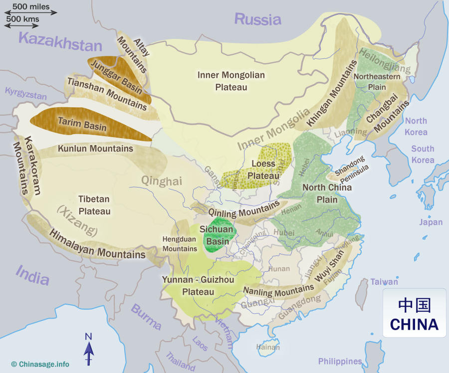
Hover the mouse over an area in the map of China, ABclicking will take you to a section giving details about that region.
China has many distinct geographical regions. It has deserts, high mountains, grasslands, vast lakes, huge rivers, glaciers, tropical rain forests and almost every other geographical feature that you can think of.
In general, China's terrain falls in steps from the high Tibetan plateau in the south west to the flat North Coastal plain in the north east. Three great rivers run vaguely west to east to divide the nation into three east-west zones, the Huang He (Yellow River), Chang Jiang (Yangzi River) and Yu Jiang (Pearl River). North-eastern China is dominated by flat plains and coastlines while southern China is mountainous with a rocky coastline. The usual line taken to divide northern from southern China is the course of the Huai River which runs through Henan and Anhui. The lack of rain in western China is one of the most important features of China's climate (see separate climate section).
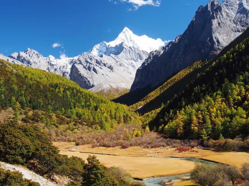
Chanadorje (Xianuoduoji, 5958m) and Chonggu Grassland, Yading National Nature Reserve. Oct. 2016. Image by Dcpeets ➚ available under a Creative Commons License ➚
Tibetan Plateau
This high plateau covers Tibet, Qinghai, southern Xinjiang and western Sichuan. It has an average altitude of 14,764 feet [4,500 meters] making it the world's highest and largest plateau. The plateau has permanent glaciers providing source water for East Asia's major rivers: Yellow, Yangzi, Mekong, Brahmaputra, Salween, Indus, Ganges and Tarim. There are many brackish lakes, the largest of which is Qinghai Lake. Monsoons over India bring heavy rain in summer to the extreme southern fringe of Tibet, elsewhere it is extremely dry. The Yarlung Zangbo ➚ Valley supports some growing of barley but elsewhere the land only provides poor pasture for yaks.
The altitude of this region falls from the Tibetan plateau in the west to about 1,640 feet [500 meters] in the east. It is scoured by very deep valleys running north to south making east-west travel almost impossible. The climate is wet and humid as tropical air from the south is funneled up the valleys making it suitable for intensive agriculture in the valley bottoms. The weathering of limestone has generated spectacular karst scenery.
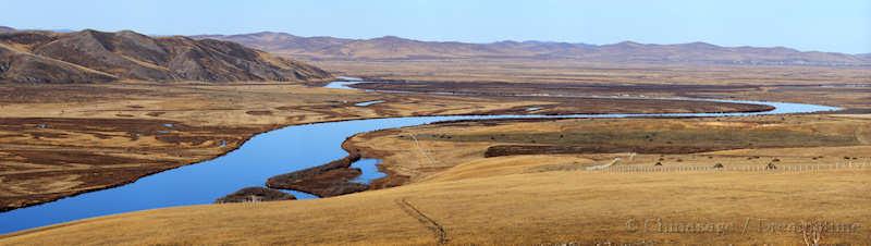
Stretching across the north of China the Mongolian plateau is broad and flat with an average altitude of 3,281 feet [1,000 meters]. Inner Mongolia covers most of the area extending into northern Gansu, Ningxia and western Manchuria (Liaoning, Jilin and Heilongjiang). No geographical feature forms China's northern border, the plateau stretches on to cover the country of Mongolia as well. Winters are cold and long with low rainfall. Underground water supplies support limited agriculture. Pasture is the main resource to support the herds of grazing animals. The climate is drier in the west and wetter in the east. The Gobi sand desert covers much of the core of this region. Taken all together deserts represent about 20% of China's land area.
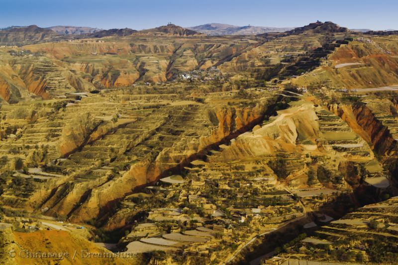
Famous for giving the Yellow River its color, the yellow loess plateau stretches south of the Gobi Desert covering Shanxi and parts of Ningxia; Gansu and Shaanxi. Loess (fine calcareous sand and silt) forms in places a 197 feet [60 meters] thick layer of friable yellow earth with an average altitude of 3,281 feet [1,000 meters]. The soil retains water well, and that is the reason that this dry region can still produce high crop yields. Over-cultivation of the land over the centuries has removed the important vegetation that bound the soil together; and now vegetation is sparse. Trees find it hard to become established in the fine, dry earth. Rainfall is infrequent but heavy and these deluges move vast amounts of material causing flash flooding. Terracing of the hills has greatly increased the area available for cultivation. Traditionally houses were made by excavating caves into loess cliffs (most famously at Yan'an), the caves are cool in summer and warm in winter.
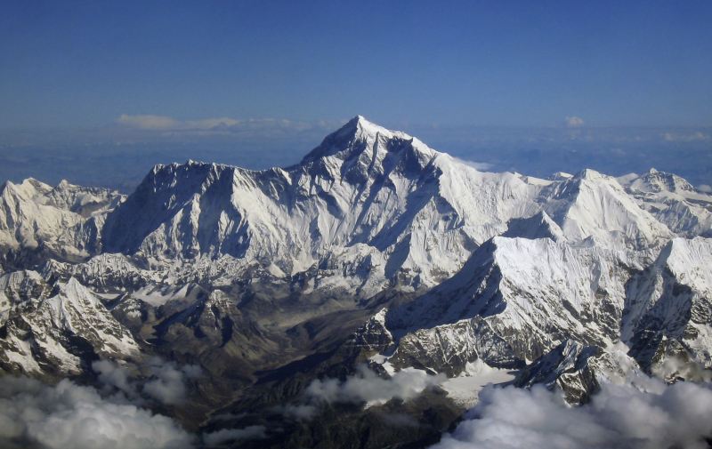
Mount Everest as seen from the aircraft of Drukair in Bhutan. The aircraft is south of the mountains, facing north. 2006. Image by shrimpo1967 ➚ available under a Creative Commons License ➚
Himalayan Mountains
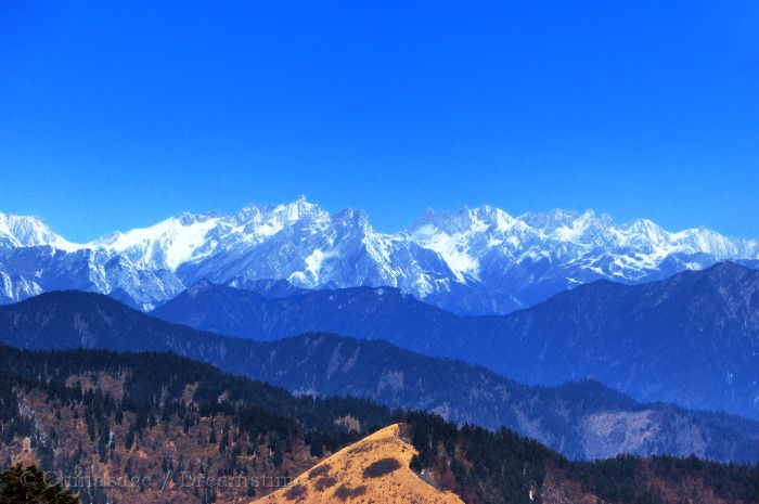
The highest mountains in the world are on the southern edge of the Tibetan plateau. Mount Everest and other high peaks form the most secure of all land borders. Himalaya means ‘Home of snow’ ➚ in Tibetan. Nine of the top 14 highest mountains in the world are in this range. The southern slopes receive huge amounts of rainfall as warm, moist monsoon air hits the mountain barrier.
These mountains form the far north-western border of China with Mongolia and Russia; they rise to 9,843 feet [3,000 meters].
Tianshan Mountains
The 天山 Tiān shān range that rise to 16,404 feet [5,000 meters] stretch from Kyrgyzstan into China to form a divide between the Tarim depression to the south and the Junggar basin to the north. The ancient Silk Route into China passed close to the mountains, with alternative ways to the north (via Alma Ata) or south (via Kashgar) to avoid the high peaks. The influence of Arctic air over Russia brings rain to the north of the mountains, producing rich pasture land.
Rugged Kunlun mountains
Kunlun Mountains
Forming the northern edge of the Tibetan Plateau and stretching into western Sichuan, the Kunlun Mountains define the border of Tibet. At about 16,404 feet [5,000 meters] with peaks up to 22,966 feet [7,000 meters] the 昆仑 Kūn lún mountains are a little known but impressive range. The precious mineral jade has been mined here for thousands of years.
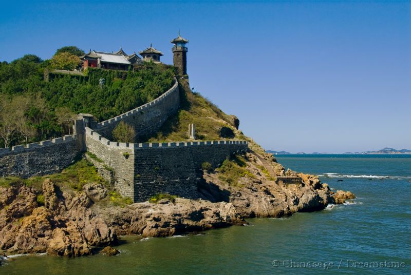
Penglai Pavilion at the northern tip of Shandong province
Shandong Peninsula
The Shandong or Jiaodong peninsula is like an island set in the North China plain. Historically the high mountains have made internal settlement difficult so many towns are spread along the rocky coastline with transport by boat. The surrounding North China Sea gives it a moist maritime climate, at least near the coast. On the western side the mountains fall away to a flat plain. The Yellow River has in historical times flowed south of Shandong's western edge cutting it off from the rest of China.
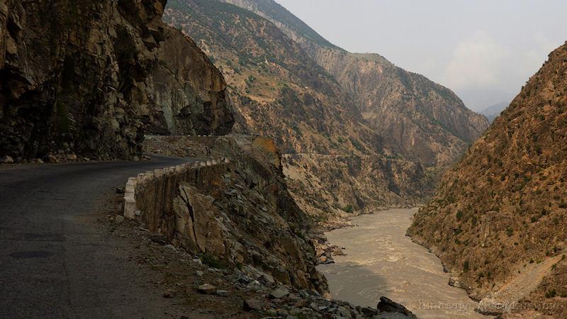
The Karakoram (or Karakorum) Pass is one of the most important mountain passes into western China. The mountains form the border with Pakistan, Afghanistan, India and Tajikistan. The second highest mountain in the world, K2 ➚, is located in this range.
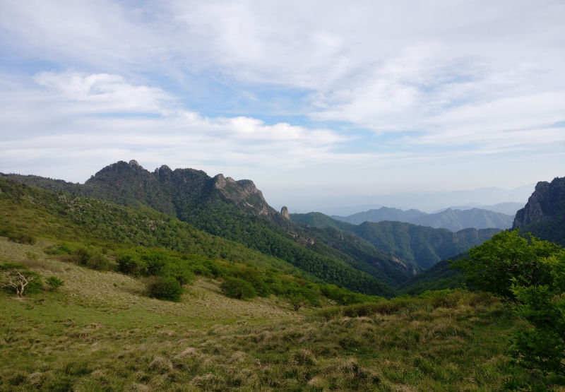
shoot on 2017/05/28 Xi'an, Shaanxi, China, by charlie Yan part of the mountains. Image by Charlie439753 available under a Creative Commons License ➚
Qinling Mountains
The 秦岭 Qín lǐng mountains form the division between the Yellow and Yangzi River basins. They jut out east from the Tibetan plateau into the North China plain forming the northern edge of the Sichuan basin. Rising to 9,843 feet [3,000 meters] they make an important historical and climatic dividing line in China between ‘north’ and ‘south’. They prevent moist summer air reaching further north and in winter cold air reaching central China.
Nanling Mountains
South of the 南岭 Nán lǐng mountains is the basin of the Pearl River draining south into Guangdong, to the north the Yangzi river drains east towards Nanjing. Relatively low at 3,281 feet [1,000 meters] the mountains are rugged with deep valleys. They form a climatic division between the tropical high rainfall of the south and the drier, cooler part of central China.
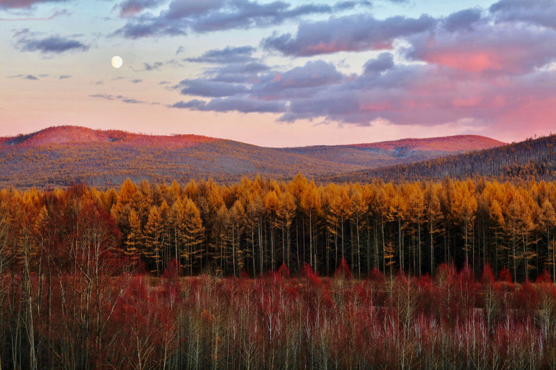
Separating Siberia from the flat Manchurian plain these mountains enhance the rainfall that falls over north-eastern China. They are split into the ‘Greater Khingan’ (大兴安岭 Dà xīng ān lǐng) running southwest to northeast and the ‘Little Khingan’ (小兴安岭 Xiǎo xīng ān lǐng) running northwest to southeast forming the northeastern border with Russia. They are densely wooded with conifers, providing a great deal of timber for China and home to the few remaining Siberian tigers.
Hengduan Mountains
Separating the Tibetan Plateau and the Yunnan-Guizhou Plateau is a transitional zone of high mountains with deep valleys running north-south. Héng duàn 横断 means ‘cut across’ in Chinese. Many of the mountains are over 19,685 feet [6,000 meters] high.
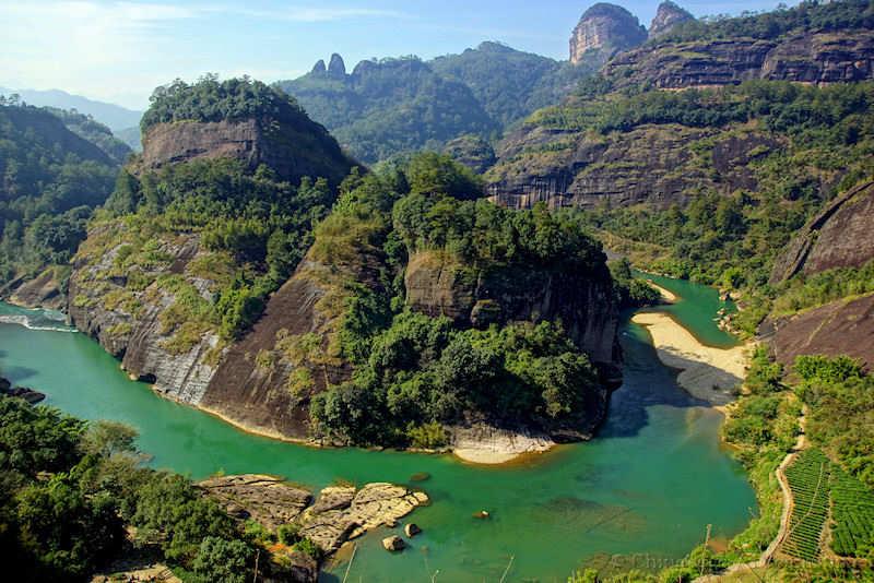
The Wuyi Shan form a continuation of the Nanling mountains in an arc along the southeastern coast which isolate Fujian from the rest of China. The 武夷山 Wǔ yí shān mountains are at the heart of this rugged barrier. Travel to Fujian was historically by boat to its many coastal ports rather than crossing these high mountains.
Surrounded by the Khingan mountains the north-eastern alluvial plain of Manchuria is an important agricultural zone. With very cold winters in the north the growing season is limited in length. It is geologically a sedimentary basin. Wheat, soybean, sorghum, sugar beet and flax are the main crops. The lower stretches of the 辽河 Liáo river form marshy ground in Liaoning province.
The majority of the Chinese population lives on the vast North China Plain stretching from the north at Beijing to the south at Hangzhou, Zhejiang and from west at Yichang, Hubei to the Eastern sea. The Yangzi and Yellow rivers compete to provide the rich alluvial soil needed to support the high agricultural output. Prone to catastrophic flooding and dramatic changes of river course, life on the plain has at times been very perilous. The Three Gorges Dam and the canalization of the Yellow River have much reduced the risk in recent years. Considerable quantities of rice are grown generally in the southern half of the plain.
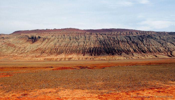
Landscape near Turpan in North West China - the hottest place in China
Tarim Basin
The arid Tarim Basin holds at its heart the scorching sand desert of the Taklamakan ➚ (literally translated as ‘go in, not come out’). The average elevation is a huge step down from the Tibetan Plateau at about 3,281 feet [1,000 meters]. On the northern edge runs the Tarim River 塔里木河 Tǎ lǐ mù hé (1,305 miles [2,100 kms] long) but it dries up before it can leave this arid area. It is cold in winter and scorching hot in summer. At the north-eastern edge is the deep depression of Turpan. Here the land falls to 833 feet [254 meters] below sea level - the second lowest in the world after the Dead Sea ➚ and here the summer heat is trapped making it the hottest place in China at 49 ° C [121 ° F].
Junggar Basin
The Tianshan mountains separate the Tarim basin from its northern neighbor the Junggar Basin (准噶尔 Zhǔn gá ěr). From the north western direction a little more rainfall is received than the Tarim so it is possible to cultivate more crops in a few pockets, but it is mainly desert.
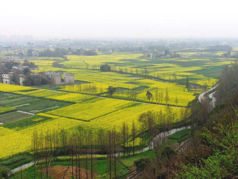
Nestled by mountains on three sides the Sichuan or ‘Red basin’ receives a high rainfall from southerly, warm, moist winds. The average elevation of the Sichuan Basin is quite high at 1,969 feet [600 meters]. Winter frosts are extremely rare. It is also named the ‘Red basin’ after the iron rich color of the soil. The good soil and favorable climate produce high yields of many crops.
Chinese Geographic terms
The names of Chinese provinces, cities and regions use common elements that are helpful to know when touring China and interpreting maps.
chéng shì
城市
City or large town
chéng zhèn
城镇
Town
chí
池
Small lake, pond or pool
chì lǔ
斥卤
Saline marsh or salt marsh
cūn zi
村子
Village
daǒ
岛
An Island. The character is a representation of a bird on a mountain. As in Qingdao 青岛, Shandong.
dì tú
地图
Map or chart
dòng
峒
A cave or cavern
fēng
峰
Peak or summit of a mountain. As in Chifeng 赤峰, Inner Mongolia