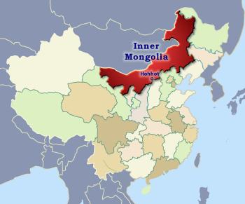
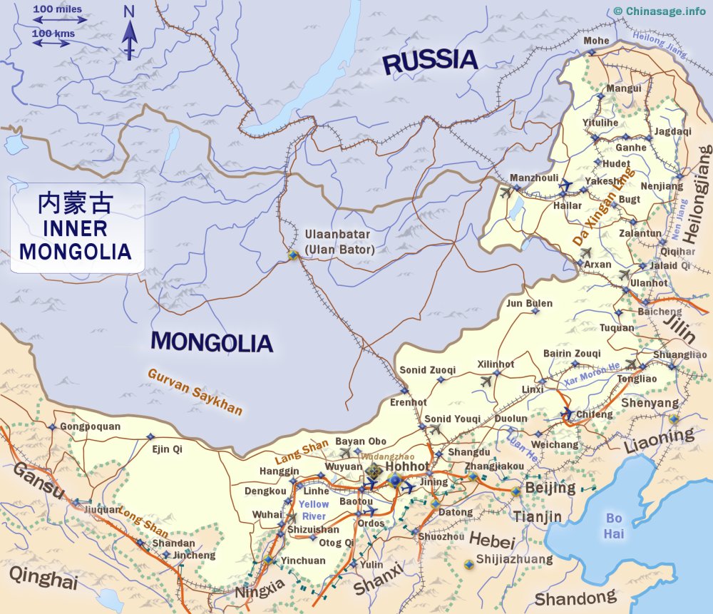
Inner Mongolia, China
| Province | Nèi měng gǔ 内蒙古 'inner Mongol ancient' |
| Short name | 蒙 Měng |
| Capital | Hohhot |
| Population | 24.049 million (1.70%) [25th] comparison table |
| Area | 1,200,000 km2 [463,320 mile2] (12.50%) [3rd] |
| GDP | 72,185 (6.94%) [12th] |
| Neighbors | Russia Mongolia Gansu Ningxia Shanxi Hebei Liaoning Jilin Heilongjiang Shaanxi |
| Others | or just click on the map |
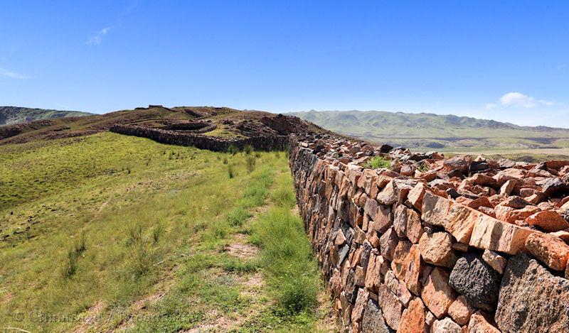
Inner Mongolia is China's third largest region by area. It forms an arid buffer zone between the rest of China and Mongolia and Russia to the north. The Gobi desert is at its heart; to its East is the Heilongjiang (Amur) River and to the south the Great Wall.
Population is concentrated near the loop of the Yellow River and along the border with the provinces to the south. It is one of China's Autonomous Regions (AR) rather than a province to reflect the large numbers of ethnic peoples. Inner Mongolia is also known as Nei Mongol or Nei Monggu (Nei meaning near or inner) to differentiate it from Outer Mongolia which is now the separate nation of Mongolia. Parts of the province, particularly the Ordos ➚ region contained in the bend of the Yellow River have been settled by Chinese people from earliest times. Mongol people form the dominant ethnic group and they follow the Lamaist Buddhist religion. The Mongolian language is widely spoken and it is frequently seen written on signage for roads and shops.
Hohhot
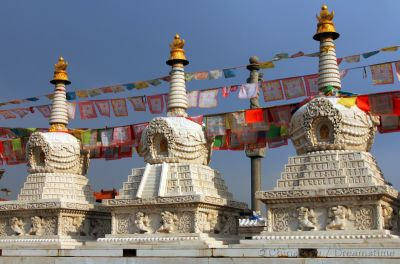
Hohhot or in Mandarin Chinese 呼和浩特 Hūhéhàotè (also Huhehot) is the capital of Inner Mongolia; it is a city 400 years old with many Buddhist temples. Hohhot is the Mongolian name and means ‘blue city’. Sights to see include the Inner Mongolia museum ➚; Xilitu Zhao ➚ temple; Drum Tower;Wutasi ➚ (five pagodas); Dazhao Temple ➚; Wang Zhaojun ➚ tomb and the Emuqi Zhao Great Mosque (reflecting the large Hui/Muslim population).
Elsewhere in Inner Mongolia
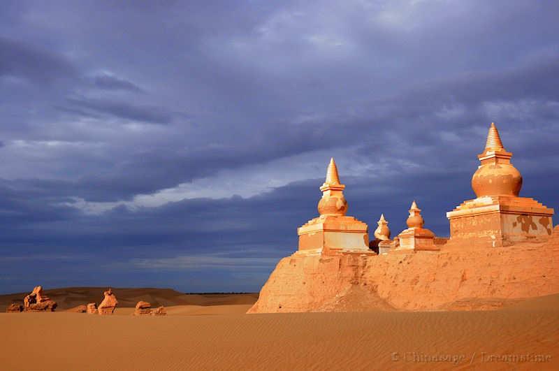
Baotou the largest city, is close by the Yellow River and has a large coal and steel industry. Inner Mongolia has extensive coal deposits, second only to Shanxi province. Wudangzhao (Willow) Monastery ➚ near Baotou is a famous Tibetan Buddhist Monastery. Xanadu (Shandu) the palace of Kublai Khan ➚ made famous by Samuel Taylor Coleridge ➚'s poem is located 199 miles [320 kms] north of Beijing and is just a pile of crumbled mud walls in the desert.
“In Xanadu did Kubla Khan
A stately pleasure-dome decree:
Where Alph, the sacred river, ran
Through caverns measureless to man
Down to a sunless sea.
So twice five miles of fertile ground
With walls and towers were girdled round;
And there were gardens bright with sinuous rills,
Where blossomed many an incense-bearing tree;
And here were forests ancient as the hills,
Enfolding sunny spots of greenery. ”
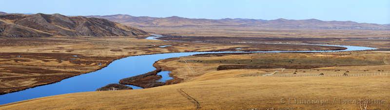
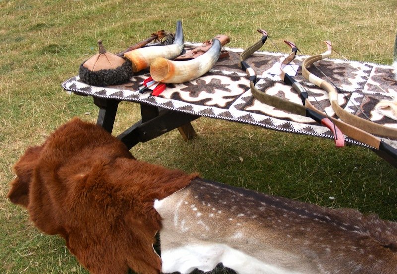
The Mausoleum of Genghis Khan ➚ can be seen at Dongsheng (although this is a shrine rather than his burial place which has never been discovered). The Wulantuge and Gegentala ➚ grasslands are places where Mongolian nomadic people can still be seen living in traditional yurts. The yurt is a portable tent made of thick felt which can accommodate a family although larger ones can hold one hundred people.
Ulanhot in the northern part has the Moli Miao Buddhist Temple; Jialan Shan Monastery is split in two parts by mountains. Manzhouli is on a railway into Russia and has some Russian style buildings.
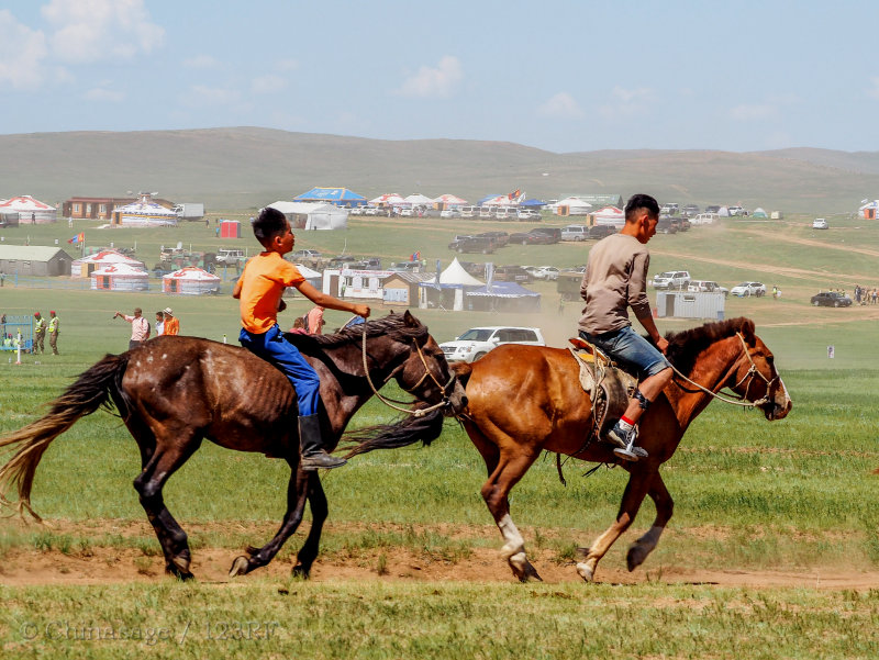
Hexigten Global Geopark ➚ near Chifeng has a granite landscape and hot springs. The Naadam Festival ➚ is a large Mongolian gathering with sports and other activities each year often on horseback. It is held in July or August at various locations and attracts large crowds. Xilinhot (Abagnar Qi) is a typical Mongolian town set in pasture land. As a sign of the times motorbikes rather than horses have become the preferred beasts of burden for young Mongolians
History of Mongolia
Parts of the Great Wall were built about 1000BCE to keep the marauding people of the Mongolian plain out of settled Han Chinese settled country to the south. Emperor Qin Shihuangdi linked these parts together to form the Great Wall. The Xiongnu tribe were the main threat in these early days. After the fall of the Tang dynasty the Liao and Jin kingdoms/dynasties had their center in the region .
Mongolia was the base for Genghis Khan and his vast Mongol Empire. Activity was centered on the Onon River that flows east into the Heilongjiang in the northeast of Mongolia. His grandson Kublai Khan overran the whole of China to form the Mongol dynasty. After the dynasty and the empire fell, Mongolia came back under Chinese rule under the Qing dynasty when both Inner and Outer Mongolia became part of China. Towards the end the Qing dynasty, Russia expanded south and east creating friction over control of Mongolia. In 1924 the Russian Red Army established the Mongolian People's Republic in present day Outer Mongolia and it has remained under strong Russian influence ever since. Inner Mongolia was a battleground between Russian, Japanese, Chinese and Mongol forces from the decline of the Qing until the formation of the People's Republic. New railways linked it with northern China and many Han Chinese settled in the southern belt.
Geography
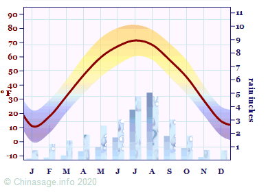
Inner Mongolia has long cold and dry winters with short, very hot summers. It is particularly arid in the western half. There is a good proportion of ethnic Mongolians and other nationalities (20%), in fact here there are more ethnic Mongols in the province than in the whole of the neighboring nation of Mongolia. Industry and agriculture are fairly limited, particularly in the harsher desert regions. Extensive efforts have been made to build a shelter belt of forests to protect the neighboring provinces from the influx of sand from the Gobi desert. The widepsread husbandry of grazing animals produces leather, lamb and cashmere while the coniferous forests in the far north east provide considerable softwood timber.
Airports
The airport has 1 terminal and is located 9.3 miles (15.0 kms) from Ordos. Live Flight information ➚, Airport information ➚, rank in China 57
See map of location Ordos Ejin Horo Airport
The airport has 1 terminal and is located 13.7 miles (22.0 kms) from Baotou. Live Flight information ➚, rank in China 54
See map of location Baotou Erliban Airport
The airport has 2 terminals and is located 9.3 miles (15.0 kms) from Hohhot. Live Flight information ➚, rank in China 33
See map of location Hohhot Baita International Airport
The airport has 1 terminal and is located 4.4 miles (7.1 kms) from Hulunbuir. Live Flight information ➚, rank in China 53
See map of location Hulunbuir Hailar Airport
The airport has 1 terminal and is located 8.7 miles (14.0 kms) from Chifeng. Live Flight information ➚, rank in China 77
See map of location Chifeng Yulong Airport
Google map of Inner Mongolia
Bing map of Inner Mongolia ➚
Show Bing Map ➚
Inner Mongolia Climate
| Major Cities | Population | |
|---|---|---|
| Baotou | 包头 | 2,181,077 |
| Chifeng | 赤峰 | 1,175,391 |
| Hohhot | 呼和浩特 | 2,681,758 |
| Hulunbuir | 呼伦贝尔市 | 365,012 |
| Ordos | 鄂尔多斯 | 693,038 |
| Tongliao | 通辽 | 921,808 |
| Ulanqab | 乌兰察布 | 425,059 |
| Wuhai | 乌海 | 218,427 |
| Yakeshi | 牙克石 | 116,284 |
Book: China : Eyewitness Travel: Dorling Kindersley: 2012 pp. 467-474
Book: China A to Z: May-lee Chai and Winberg Chai: Plume: 2007 pp. 145-146
Web page: Book: Chinese Common Knowledge: Geography: Wang Yi: 2004: Hong Kong Chinese… ➚ pp. 157-159
Book: Insight Guides: China: APA publications: 1994 pp. 222-223
Book: Lonely Planet: China: 1988 pp. 714-729
Book: Modern China: A companion to a rising power: Graham Hutchings:… pp. 228-229
Book: Nagel's Encyclopedia guide: China: Nagel: 1978 pp. 1397-1421
Book: Symbols of China: Feng Jicai: Compendium: 2010 p. 167
Web page: Inner Mongolia (wikitravel) ➚
Web page: Inner Mongolia Travel - Endless Grassland With Fine Horses And Blue Sky ➚
Web page: Map of Inner Mongolia Autonomous Region: China ➚
City populations for 2012, Province statistics National Bureau of Statistics 2014