Xinjiang Tibet Qinghai Gansu Yunnan Sichuan Inner Mongolia Heilongjiang Guangxi Jilin Hainan Guangdong Ningxia Liaoning Guizhou Chongqing Hunan Fujian Jiangxi Zhejiang Shaanxi Hubei Anhui Jiangsu Shanxi Henan Shandong Hebei Beijing Tianjin Mongolia (Country) North and South Korea Kazakhstan (Country) Kyrgyzstan (Country) Afghanistan (Country) Tajikistan (Country) Pakistan (Country) Russia (Country) India (Country) Nepal (Country) Bhutan (Country) Laos (Country) Myanmar / Burma (Country) Vietnam (Country) Taiwan Japan Shanghai Hong Kong Macau
Map of all Chinese provinces
selected province

Chinese provinces

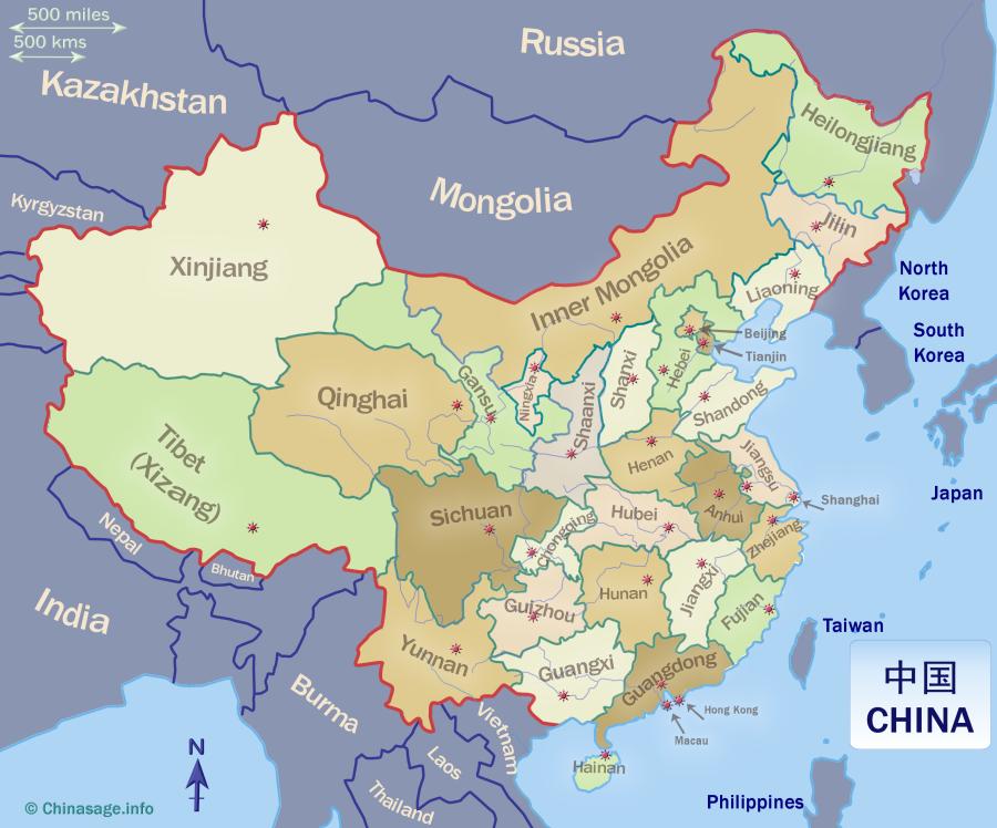
Here are all the Chinese provinces. You can click on the column header to sort the table; click on the province name to select it in the table and on the map, or Double Click to go to the province's full information page.

Other pages in our China geography section cover the country of China, the countries that surround China; information on all the principal cities; airports; visitor attractions; universities; the ethnicity of the people of China; thoughts about China's future and China's climate. As well as a detailed page on each individual province (including a map) are other pages describing the geography and historical features of China: the Yellow River; Yangzi River; Great Wall and the Silk Road.


NameChineseShortCapitalPopulationAreaDensityGDPLiteracyEthnicityInformation
Tibet西藏zàng Lhasa3.61,2302.9752,15762.23%46%details map
Jilin吉林Changchun24.1187128.7351,14198.08%9%details map
Beijing北京jīng Beijing City21.9171287.82164,90498.30%4%details map
Zhejiang浙江zhè Hangzhou64.6102633.02100,07194.38%10%details map
Anhui安徽wǎn Hefei61.0140435.9163,38391.66%1%details map
Hunan湖南xiāng Changsha66.4212313.4262,88197.33%10%details map
Shanxi山西jìn Taiyuan34.9156223.8250,55697.87%0%details map
Hebei河北Shijiazhuang74.6188396.8648,52897.39%4%details map
Shandong山东Jinan101.5157646.6772,02995.03%1%details map
Henan河南Zhengzhou99.4167595.0155,34895.75%1%details map
Yunnan云南diān Kunming47.2394119.8251,94393.97%17%details map
Xinjiang新疆xīn Urumqi25.91,60016.1653,37197.64%7%details map
Guangxi广西guì Nanning50.1237211.5144,20197.29%38%details map
Guangdong广东yuè Guangzhou126.0178707.9487,89798.04%2%details map
Sichuan四川chuān Chengdu83.7485172.5358,08094.56%5%details map
Jiangxi江西gàn Nanchang45.2167270.5956,85496.87%0%details map
Shaanxi陕西shǎn Xi'an39.5206191.8966,23596.26%1%details map
Hainan海南qióng Haikou10.134296.5054,87895.92%17%details map
Fujian褔健mǐn Fuzhou41.5122340.49105,69097.56%2%details map
Jiangsu江苏Nanjing84.7103822.80121,20596.19%0%details map
Liaoning辽宁liáo Shenyang42.6146291.7258,96798.07%16%details map
Hubei湖北è Wuhan57.8186310.5075,22395.42%4%details map
Guizhou贵洲qián Guiyang38.6174221.6246,22891.26%38%details map
Chongqing重庆Chongqing City32.182390.9078,00295.70%7%details map
Gansu甘肃gān Lanzhou25.045455.1136,03891.31%9%details map
Heilongjiang黑龙江hēi Harbin31.946967.9143,00997.94%5%details map
Macau澳门ào Macau City0.71683.00269,13191.30%8%details map
Inner Mongolia内蒙古měng Hohhot24.01,20020.0472,18595.93%21%details map
Ningxia宁夏níng Yinchuan7.266109.1454,43293.78%35%details map
Qinghai青海qīng Xining5.97208.2350,74289.77%46%details map
Shanghai上海Shanghai City24.964145.17155,60697.26%1%details map
Tianjin天津jīn Tianjin City13.9111260.55101,57097.90%3%details map
Hong Kong香港gǎng Hong Kong City7.517474.00314,18793.50%6%details map

Click on a row to select the province and highlight it in the map. Click on a column header to sort the provinces by that column. Here is a key to the information displayed in the table:
ChineseThe province name in Chinese
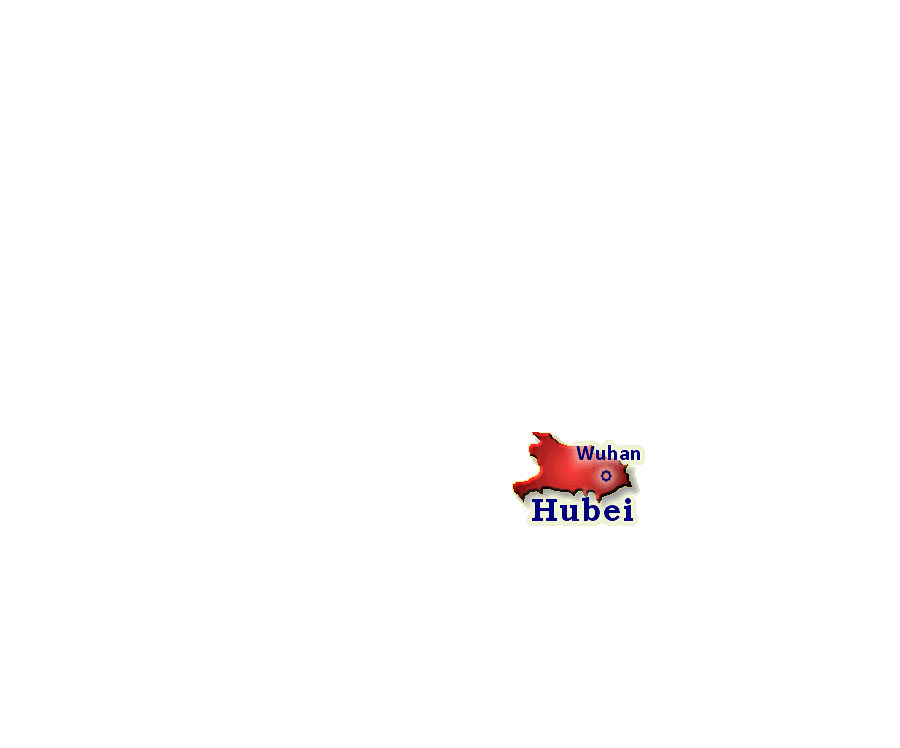
CapitalThe capital city of the province
ShortThe short name for the province in Chinese. Used on, for example, vehicle license plates.
PopulationThe population of the province in millions (National Bureau of Statistics 2021)
AreaThe land area of the province in thousands of square kilometers (Goddard 1997)
DensityThe number of people per square kilometer i.e. (Population/Area)
GDPGross Domestic Product in Chinese Yuan of the province per person (National Bureau of Statistics 2020)
LiteracyProportion of people who can read and write (Bureau of Statistics of the PRC 2010)
EthnicityPercentage of people who are not Han Chinese (China Statistical Yearbook 2007)
InformationLink to a full description of the province and also to a Google map of the province

Chinese Geographic terms

The names of Chinese provinces, cities and regions use common elements that are helpful to know when touring China and interpreting maps.

chéng shìCity or large town
chéng zhènTown
chíSmall lake, pond or pool
chì lǔ斥卤Saline marsh; salt marsh
cūn ziVillage
daǒAn Island. The character is a representation of a bird on a mountain. As in Qingdao , Shandong.
dì túMap or chart
dòngA cave or cavern
fēngPeak or summit of a mountain. As in Chifeng , Inner Mongolia
gāo yuánPlateau
gōng lùHighway, public road
gōng yuánPublic recreational park
gōuRavine or gully
haǐSea. As in Haimen , Jiangsu and Qinghai
haǐ yángOcean (vast sea)
haǐ tānBeach
River. As in Shihezi , Xinjiang
huǒ shānVolcano. Literally 'fire mountain'.
Lake. As in Wuhu , Anhui
jiāngLarge river. As in Lijiang , Yunnan
pù bù瀑布Waterfall
sēn línForest. The two characters are made up of five 'trees'.
shā mò沙漠Desert
shānMountain. As in Foshan , Guangdong
shān gǔValley
shān màiMountain Range
shěngProvince
shìCity
shù línWoodland
shuǐWater. As in Tianshui , Gansu
shuǐ kùWaterfall (literally 'water storehouse')
tánPool or pond. As in Xiangtan 湘潭, Hunan
tiě lùRailway; railroad (literally 'iron road')
Stream; brook. As in Benxi , Liaoning
xiáGorge; deep ravine
xiànCounty (administrative division)
xiaǒ lùPath; footpath
yángThe 'sunny side' of yin-yang so quite often a component of city names open to the sun. As in Shaoyang , Hunan
yùn héCanal
zhaǒ zéSwamp or marsh
zhènSmall town
zhōuPrefecture (administrative division). As in Xuzhou , Jiangsu; Guangzhou 广, Guangdong
zì zhì qūAutonomous region of minority people.

See also